Part 1
First of all I’d like to say Waynesboro is a great town. Food, history, and friendly to hikers. Had a great time! Ming’s Chinese Buffet did not disappoint.
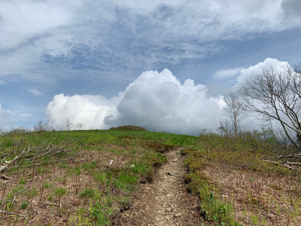
Leaving Waynesboro you enter the Shenandoah National Park. We got a late start but only had 7.5 miles to Calf Mountain Shelter. The weather was windy but most of the rain was left back in Waynesboro. Elevations weren’t crazy either but after 2 days in town I felt clumsy. To be honest I was disappointed. The surrounding trees on Calf Mountain were smallish and scrubby looking. I learned later that the acidic soil may contribute to some of the stunted size of the trees. The underlaying rock is rich in quartzite which breaks down over time into highly acidic soil. Which in turn effects what plants and trees can thrive in that location. Azalea, blueberry, mountain laurel can be found here.
When you leave town to get back on the trail and a shuttle drops you off, the transformation back to a hiker is rather quick. You get out, throw the pack on and start walking in a matter of minutes. I have a hard time getting right into the swing of things and this cold and blustery day was no different. I came out of the woods at Beagle Gap and the 25-35 mph winds literally blew me off the trail twice. Temperature was around 45 and I had sent my gloves home figuring all the cold weather was passed. Anyways it wasn’t a bad hike but I struggled worse than I should have. That night the wind continued to blow with severe gusts and temps lowered to 40 degrees.  I awoke to find a bear had tried to access my food canister leaving scratches and a possible bite mark. He also had move the canister about 25 feet. Doc and Solo were there as were 3 other college age thru hikers.
At 8:15 we started north for Black Rock Hut 13 miles away. Today I felt different. This was a turning point in my hike. My legs felt stronger. I seemed to be in sync with the multitude of rocks in my path. I was able to maintain a smooth stride and adjust to the trail changes with less wasted effort. Finally a little speed! The terrain helped too. There were no 1000 ft. climbs but a 500 ft. down and then 800 ft. up followed by a series of ups and downs. At the end of the day I was tired but probably my best day hiking. Saw a buck and three does.


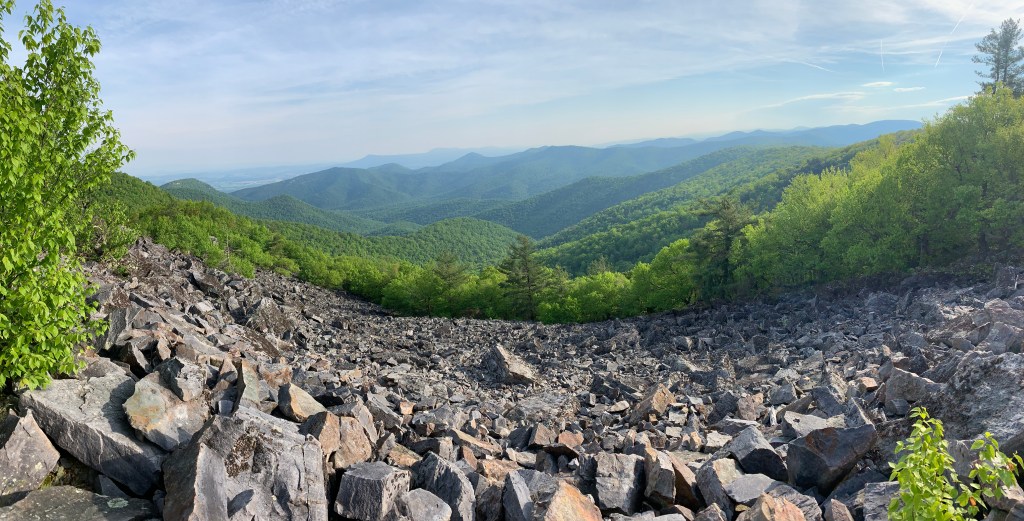
BlackRock Hut to Pinefield Hut 13.2 miles. Another good start. I’m starting to hike real fast. Arrived at Loft Mountain by 12:00 and resupplied with a couple of meals. Also had a coke, chips, ice cream, candy bar, anything for calories as I’m still losing weight. These last 2 days weren’t killer climbs but all have at least one 500 footer. I can climb these quickly now but my sprinting style of hiking up hill is taxing my lungs. I’ve tried to slow it down but for whatever reason it doesn’t work for me. This day would take us past many rocks including Black Rock Mountain. The rock is volcanic thus the black color.

This would also be a hard day on both my feet. I have been hiking with a third person, Steak”N”Shake since the start of the Shenandoah Nat.Park. He is section hiking with the goal of Harpers Ferry this year. Along with Jed Morgensen, and myself (we tend to hike the same number of miles each day) we have become a team of three.
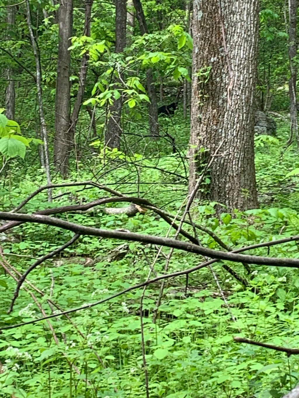
Next day was off to Hightop Hut only 8 miles away. Before we started, Larry in his 70’s from the Potomac AT Trail Maintenance Club stopped by to service the shelter. He filled us with stories about bears, Shenandoah, Trail Maintenance etc. while we packed up. He lives 10 miles away, routinely checking on this shelter. Today I would see my first bear! There was evidence of bears all along the trail ever since entering the park. I was coming down into Powell Gap and heard a loud branch crack. I knew it wasn’t a small animal so I scanned the hillside. Nothing. I took 10 more steps around a bend in the trail and there he was looking straight at me. Probably 30 yards away. At first I just wanted to get my phone out but would have to abandon my trekking poles. I was told to raise them up and make myself look bigger so I thought it best just to observe and see if he was concerned about my being in his playground. He sat up on his hind end and just stared at me. Not seeming aggressive I decided to back up a little and shed my poles, got my phone ready to take a picture but he started to leave just as my two hiking companions arrived. We all tried to get his picture and I finally grabbed one before he disappeared.
This would be a harder hike than expected. We started with a 350 ft. up, down 500 than up 700, down 750 and finally up 400 feet, which would have been 900 except the shelter was 400 feet below the top. Despite the low miles it took 5.5 hours to get there. Along the way I saw Mighty Blue who is an author of two book describing his trail experience and has a well known podcast about hiking the AT. He is hiking the trail for the second time. I told them of our plans to camp at Lewis Mtn. Campground the next night and they advised calling as soon as we got a cell tower signal. We did and all property in Shenandoah was booked for the weekend. That put a big kink in our plans.

High Top Hut to Lewis Campground. 11.6 miles It was a very hot day with huge elevation totals. A few more than 500 feet.We went to the camp store and resupplied. I ate all the extra chips and snacks I could find. I had been shedding pounds fast and could not get enough calories. I also took a shower for 2 dollars. There was no camping space available so we had to move on. Just before we left an afternoon shower popped up and we delayed our departure. The rain turned into trail magic! A retired veteran (Jim), and his wife (the Crazy One) had a campsite and made an offer to Steak and Shake letting us pitch our tents at their site. We said yes and spent a pleasant evening talking to them and relaxing. The Crazy One is section hiking parts of the trail and her husband Jim assists if she needs to be picked up etc. Then things got even better. Steak N Shake had a friend with an RV at another campground ahead. We had planned on resupplying there and spending the night. He called Kent and arranged to have him meet us in his RV the next morning.

 He would take all our heavy gear and allow us to just carry water and snacks the 9.5 miles to Kent’s campsite. It is called slackpacking and I was eager to find out just how fast I could hike. I think I averaged almost 4 mph. I also learned another thing. My left foot pain is caused primarily from the weight of my pack. I had no issues over the rocks except once when I got careless and out of control. Later I found out Steak N Shake had taken a pretty good fall. Bruising his arm and some ribs. He toughed it out and maintained the pace the next few days.

At Big Meadows there is a lodge with a restaurant overlooking the valley. We ate there and my meal was well over 2500 calories. The dessert was blackberry ice cream with graham cracker crust and a blackberry sauce drizzled over the top. The resupply store was closed for renovation and that along with some other things changed our plans for the day tomorrow.


 I need to explain a few things first. I had a lot of wet gear including my sleeping pad and bag from last nights rain. I was anxious to get to the next shelter and hoped the sun would shine to help dry things out. When wet a down bag has no insulation value and is very hard to get dry. The Harpers Creek Shelter was only 7.6 miles away. But it did have a 500 ft. climb, followed by a steep 3000 ft. drop and then another 800 feet up before a mile walk to the shelter. We had just done the first 500 up and halfway down the Priest when two young female hikers approached me headed up the hill. They stopped and talked for a second obviously full of energy.
 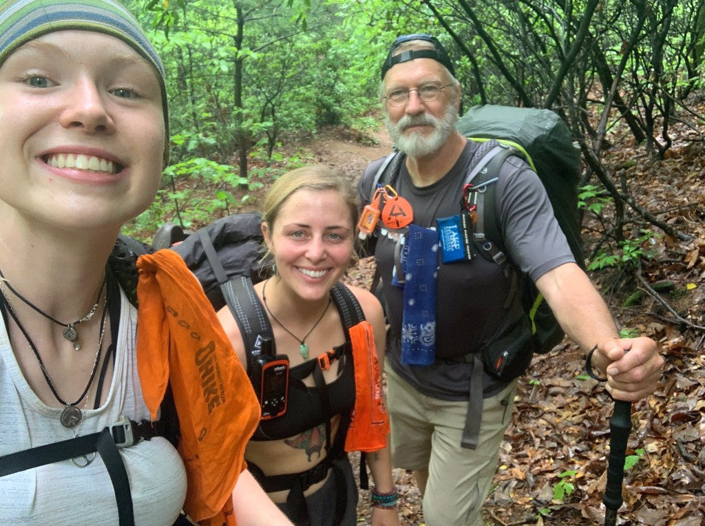 The first one (later I learned her name was Spoons) went by me and engaged Jed while I talked some more with Sunshine. You could just sense they both had been thru hikers and their friendship was equivalent to that of twin sisters. I said stay safe and headed down the hill.
  At the bottom was a parking lot and Hwy 56. I waited on Jed and watched the skies hoping the sun would come out. When Jed arrived he had a proposal if I was willing. He was inclined to change plans for the day. While talking to the female hikers he realized that he had hiked with Spoons in Maine last years thru hike attempt. She also remembered him so they offered to give us a ride to the Devils Backbone Brewery and Pub about 10 miles away. They had a free campground for thru hikers with hot showers/ bathrooms and a restaurant. On top of that they also had a hiker breakfast for 5 dollars. Sounded good but at first I was inclined to keep pushing on because I needed to dry things. After looking at the guide I realized the diversion wouldn’t delay our scheduled stop in Waynesboro. Besides that I could start drying things out in the parking lot while we waited for their return. The sun came out just enough and that with the wind I did get everything dry.


 Once on top a rocky downhill for 1300 ft. to Maupin Shelter. There wasn’t much daylight left so I immediately began chores and got ready for bed. I slept in the shelter because rain was expected by morning and needed a quick departure because Paul Wolfe Shelter was 16 miles away.
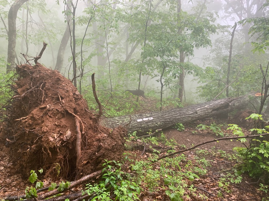 Someone said they counted over 39 on one hillside. We emerged onto the Blue Ridge Parkway and Interstate 64.
  A free shuttle took us to the hotel. We checked in and immediately went to the laundry mat. Everything I owned had to be washed so I just wore my raincoat and rain pants. It’s tough at times to be a hiker. After lunch there were more chores. However I found time to catch up on this blog. That’s a good thing! Shenandoah here I come. It is the most probable time to cross paths with a bear. Hope I know how to act.


 After this I arrived at the top just before the rain started. I came upon a monument that marked where a 4 year old boy had wandered away from school and was found the next spring. The monument marks the exact spot.

 I played Wonder by Hillsong United here.
 That ZPacks bathtub floor did its job. During the night my sleeping pad slid up against the door and my foot box on the bag was wet. Very wet. Others were worse, all their gear was soaked. Nothing to do but move on and maybe dry things out a little at lunch.

 It was an unusual spot because an FAA tower was atop the ridge. It had kind of a weird spaceship look. The Guillotine, a rock formation was just ahead in the trees so I snapped a quick picture and headed for cover. The Guillotine is two large rocks with a third rock sitting squeezed between the two. I took cover underneath and took my pack off to retrieve my rain coat. In the process I hit my head on a rock and felt for blood. I found it. Needless to say I didn’t take a picture but hurried on to the shelter a mile away. The trail was now just a river almost as high as my shoes. The rain slacked off just as I arrived. Jed Morgansen and Tank we’re headed out. Tank a retired policeman from Louisiana and I had lunch at a small stream earlier that day. I asked Tank to inspect the cut on my head. He said it wasn’t too bad so I ignored it. Found Cayenne taking a nap waiting out the storm. Eventually he would decide to spend the night. Later we were joined by Jumanji and Dory, a couple day hiking for a few days. Enjoyed there company and conversation. As bad as the day had been I felt good having covered 31 miles in 3 days despite having to stop early the first day. I planned to go to the next shelter tomorrow for another 12.5 miles.

 They pointed out different flowers as we leapfrogged each other for a few miles. Down at the parking lot where their cars were we talked and they gave me an apple.
  I climbed up another 700 ft. to Highcock Knob. I found Cayenne here eating lunch and after discussing plans I decided to call for a shuttle to Stanimals hostel in Glasgow Va. instead of stopping the night at Matt’s Creek Shelter. The pickup time was 4:00 pm. It was 12:30 when I made the call. That meant covering almost 9 miles in 3 and half hours. It would be the fastest I travelled to this point. Fortunately it was mostly downhill. I told Cayenne goodbye and sprinted down the hill. After maybe 10 minutes I realized there were no white blazes. I checked my phone and verified I was off the trail. In a minute I came to a junction with a sign. Two of the trails went to places I did not want to go. The third directed me back where I came from. I had to go a quarter of a mile uphill and start over. Now I was in a hurry. I almost ran, down the steep rocky slopes, hurting once again my foot. I stopped at the shelter I intended to spend the night and cooled off by pouring cold stream water over my head. Then I began racing again another two miles until I saw the James River.

 The trail followed beside it for a mile and a half. When I finally reached the bridge it was 3:50. I had gone almost 10 miles in 3 hours. Not the way I want to do it.


